

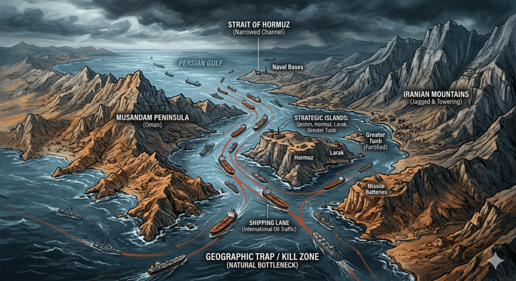
The Hormuz Straits are not just a waterway; They are a geographic trap, a natural kill zone shaped by jagged peninsulas, towering mountains, and a handful of strategically placed islands.
Imagine piloting a low-altitude reconnaissance drone at dawn, engines humming as you skim 500 feet above the turquoise waters of the Gulf of Oman. The air is thick with salt and the faint scent of crude oil from distant tankers. Ahead lies one of the world’s most critical and contested maritime arteries: the Strait of Hormuz. This narrow funnel, barely 21 nautical miles (39 km) at its tightest, funnels roughly 20-30% of global seaborne oil and liquefied natural gas. It is not just a waterway; it is a geographic trap, a natural kill zone shaped by jagged peninsulas, towering mountains, and a handful of strategically placed islands. What follows is a virtual fly-through, grounded in nautical charts, satellite imagery, and real-time maritime data, followed by an analysis of why this geography empowers Iran’s asymmetric defences and why even the world’s preeminent naval superpower, the United States, finds itself strategically hobbled here.
The Fly-Through: From Open Sea to the Persian Gulf’s Bottleneck
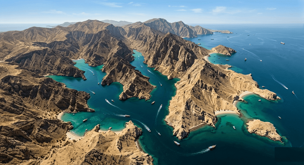
Your drone banks eastward, climbing slightly for a panoramic view. To the south, the rugged, fjord-like cliffs of Oman’s Musandam Peninsula rise dramatically, brown, fractured rock plunging into deep blue waters. This is the “headland” that forms the southern jaw of the strait. Depths here exceed 650 feet (200 meters) near the Omani shore, offering safe passage for the largest supertankers.
The Musandam’s dramatic topography, steep wadis and hidden inlets, provide natural concealment for Omani observation posts, but it also marks the start of the Traffic Separation Scheme (TSS), the internationally mandated highway for ships. Inbound traffic (heading into the Persian Gulf) hugs the northern edge of the Omani waters; outbound traffic stays closer to Iran. Each lane is precisely two nautical miles wide, separated by a two-mile buffer zone to prevent collisions. The TSS itself lies mostly in Omani territorial seas, yet every vessel must thread the needle between sovereign claims.
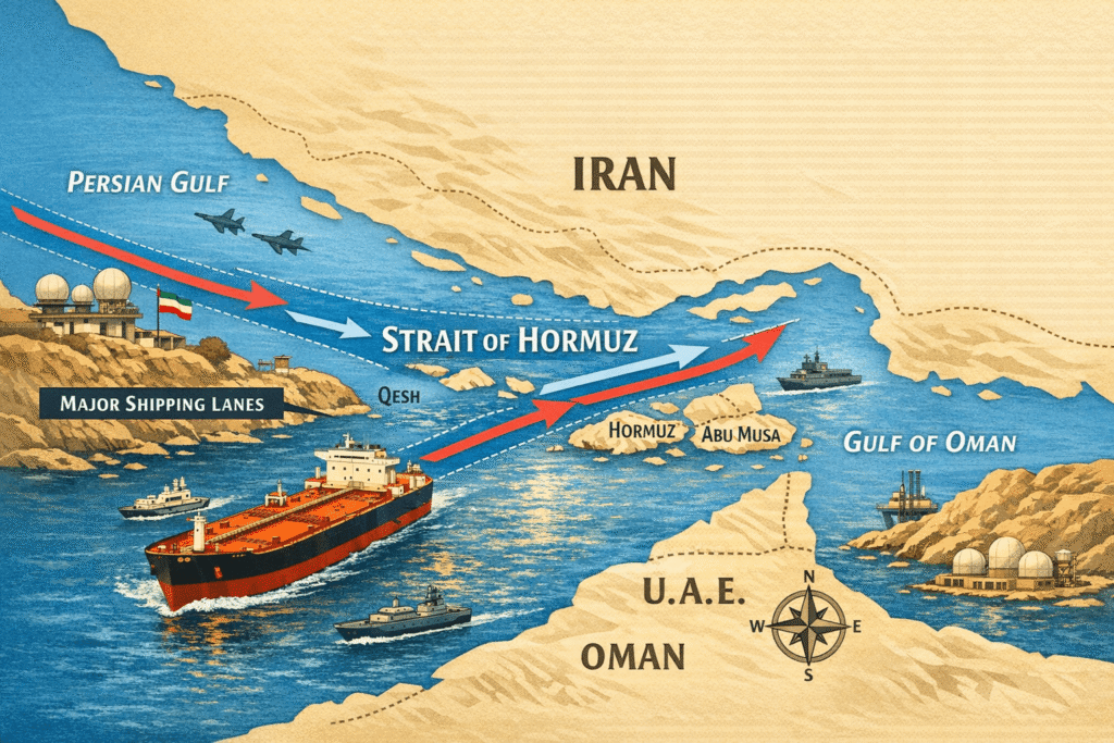
As you bank the drone westward, the strait narrows. On your right (north), Iran’s coast emerges: a rugged, mountainous escarpment dotted with military installations. The Zagros Mountains loom in the background, providing elevated vantage points for radar, missile batteries, and observation. Key Iranian ports like Bandar Abbas sit just beyond the horizon, offering rapid resupply for small craft. Islands begin to appear, first the larger Qeshm Island, Iran’s largest in the strait, a 1,000-square-mile landmass that funnels traffic into tighter channels. Then, Larak Island, a rocky outcrop used historically for surveillance and now, in conflict scenarios, for rerouting shipping around hazards.
The narrowest point approaches: just 21 nautical miles across, with the shipping lanes compressed into a corridor barely six miles wide total. I dip my drone lower, skimming over the inbound lane. Below, a lone VLCC (very large crude carrier) ploughs forward at 12 knots, its deck laden with Kuwaiti crude. To the north, Iran’s territorial waters lap against the lanes; to the south, Oman’s. Eight major islands punctuate the seascape, seven of which are firmly under Iranian control, including the disputed Abu Musa, the Greater and Lesser Tunbs. These outposts act as unsinkable aircraft carriers, bristling with anti-ship missiles and fast-attack boat bases. Depths taper here: still navigable for deep-draft vessels near the Omani side, but shoaling toward Iran, forcing the slow lumbering sea oil tankers traffic into predictable paths.
Past the pinch point, the waters widen again into the Persian Gulf proper. The Iranian coast curves northwest toward Bushehr, while the Arabian side fades into the UAE and Qatar. But the fly-through reveals the trap: every mile is within easy reach of shore-based weapons. The entire transit takes large vessels about 12-18 hours, but in a crisis, that duration becomes a vulnerability window. Mines can be laid in hours; drone swarms launched in minutes. The geography, confined waters, short lines of communication for the defender, and elevated terrain for sensors turn this strait into a defender’s paradise.
This is no abstract exercise. Satellite and nautical data confirm that the layout has changed little over the centuries, yet modern overlays reveal hazardous zones, firing practice areas, and rerouted paths imposed during periods of tension. One recent map shows a “new route” hugging closer to Iranian islands to avoid declared minefields, illustrating how geography enables selective control.
Strategic Geography: Why the Strait Matters
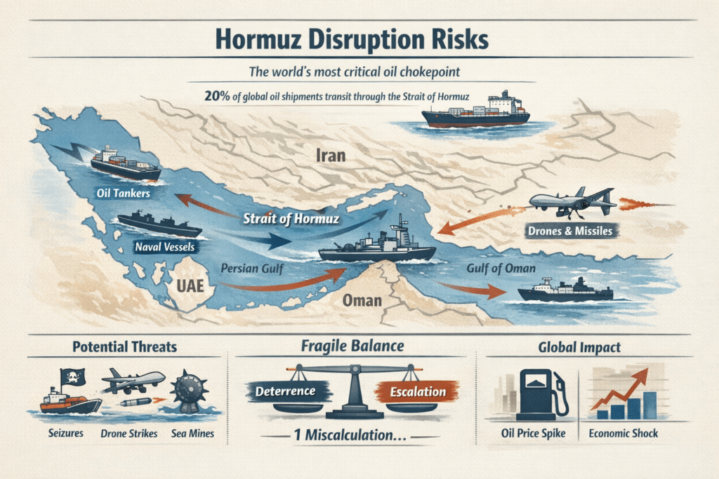
The Strait of Hormuz is not merely narrow; it is asymmetrically advantageous to the defender. The Persian Gulf side is shallower overall (rarely over 300 feet except near the entrance), while the Omani flank offers deeper, safer channels. Iran controls the northern shore and most islands, granting it de facto oversight of the primary lanes. Oman, a more neutral actor, controls the southern flank but lacks the military density to contest Iran unilaterally. The result: any disruption here ripples globally. In peacetime, 21 million barrels of oil pass daily, about one-fifth of global consumption. A closure spikes prices, cripples Asian economies dependent on Gulf exports, and strains Western allies.
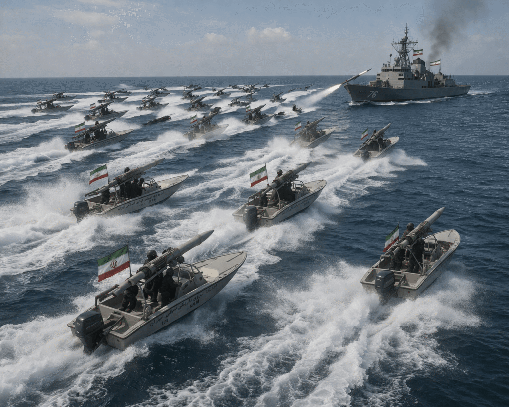
Historically, this chokepoint has been weaponised. During the 1980s Tanker War, Iran mined the waters and attacked shipping; the U.S. responded with convoys and mine countermeasures. Today’s threats layer atop the same geography: anti-access/area-denial (A2/AD) bubbles created by mobile coastal missiles, drone swarms, and naval mines. Iran’s strategy exploits the strait’s confines, short warning times for ships, limited manoeuvre room for large warships, and proximity to friendly shores for rapid redeployment.
Countermeasures: How to Break the Grip
Reopening the strait demands a multi-domain campaign, not a simple escort mission. Potential steps include the following aspects: firstly, using mine countermeasures (MCM). Iran can deploy thousands of cheap contact, influence, or limpet mines via small boats, divers, or aircraft. Clearing them requires specialised vessels (e.g., LCS with MCM modules), unmanned underwater vehicles, helicopters towing sonars, and explosive ordnance disposal teams. In the 1980s, U.S. forces cleared limited fields at high cost and risk; today’s capacity is strained, with few dedicated sweepers forward deployed. A full clearance could take weeks, during which insurance rates soar and shipping halts. Secondly, suppression of shore-based threats. Iranian anti-ship missiles (e.g., from elevated positions on the mainland or islands) and drone launchers must be neutralised via air strikes, cruise missiles, or special operations. But the mountainous terrain hides mobile launchers, bunkers and tunnels complicate targeting. Sustained suppression requires persistent air superiority and risks escalation. Thirdly, convoy escorts and swarm defence. U.S. destroyers with Aegis systems can intercept missiles and drones, while helicopters engage speedboats. Close-in weapons (Phalanx, SeaRAM) handle the leakers. Yet swarms overwhelm through numbers and low cost, $35,000 drones versus million-dollar interceptors. Fast-attack craft and explosive unmanned vessels add layers. Coalition operations (with allies providing additional hulls) distribute risk but require political buy-in. Fourthly, using alternative routes and deterrence. Pipelines bypass some Gulf producers, but not enough. Airlifts or overland routes are impractical for oil volumes. Long-term deterrence involves forward basing, mine-laying countermeasures, and diplomatic pressure on Iran. These are feasible in theory, but operationally taxing. Geography forces slow, predictable transits through a 100+ mile gauntlet under constant observation.
Why the U.S. Navy, Despite All Its Sea Power, Cannot Easily Prevail
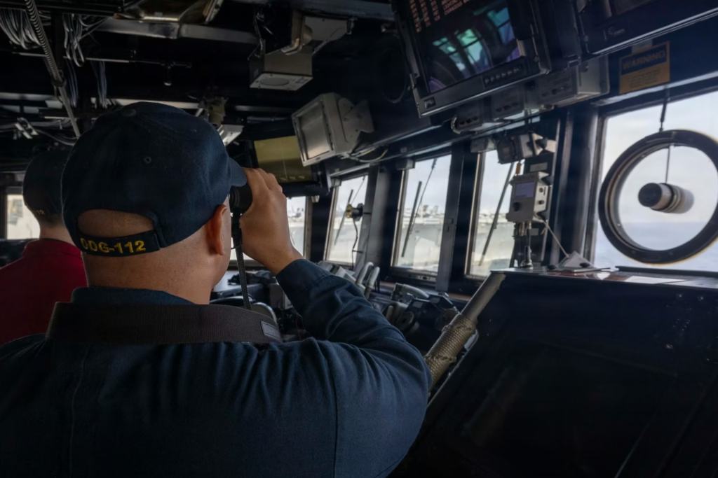
The U.S. possesses the world’s most powerful navy, carrier strike groups, submarines, advanced sensors, and global logistics. Yet in the Strait of Hormuz, it confronts a paradox: superior technology meets inferior geography and asymmetric economics. Even after hypothetical strikes that “decimate” Iran’s conventional navy, the strait remains contested. These can be explained by understanding that geography creates a kill box. The narrow lanes limit warship manoeuvrability. Carriers stay well outside missile range (hundreds of miles offshore), relying on aerial refuelling, costly and unsustainable. Destroyers and escorts must enter the confined space, where warning times shrink to minutes. Elevated Iranian shores provide line-of-sight targeting; islands serve as forward bases. Large ships cannot “hide” or outrun threats here as they could in the open ocean. This asymmetric cost exchange favours the defender. Iran deploys cheap, expendable assets: cheaper mines, drones, speedboats, and mobile missiles. A single mine or drone swarm can damage a $2 billion destroyer or tanker. U.S. defences, SM-6 missiles, CIWS are precise but expensive and finite. Prolonged engagements drain magazines faster than resupply can match, especially with global commitments elsewhere.
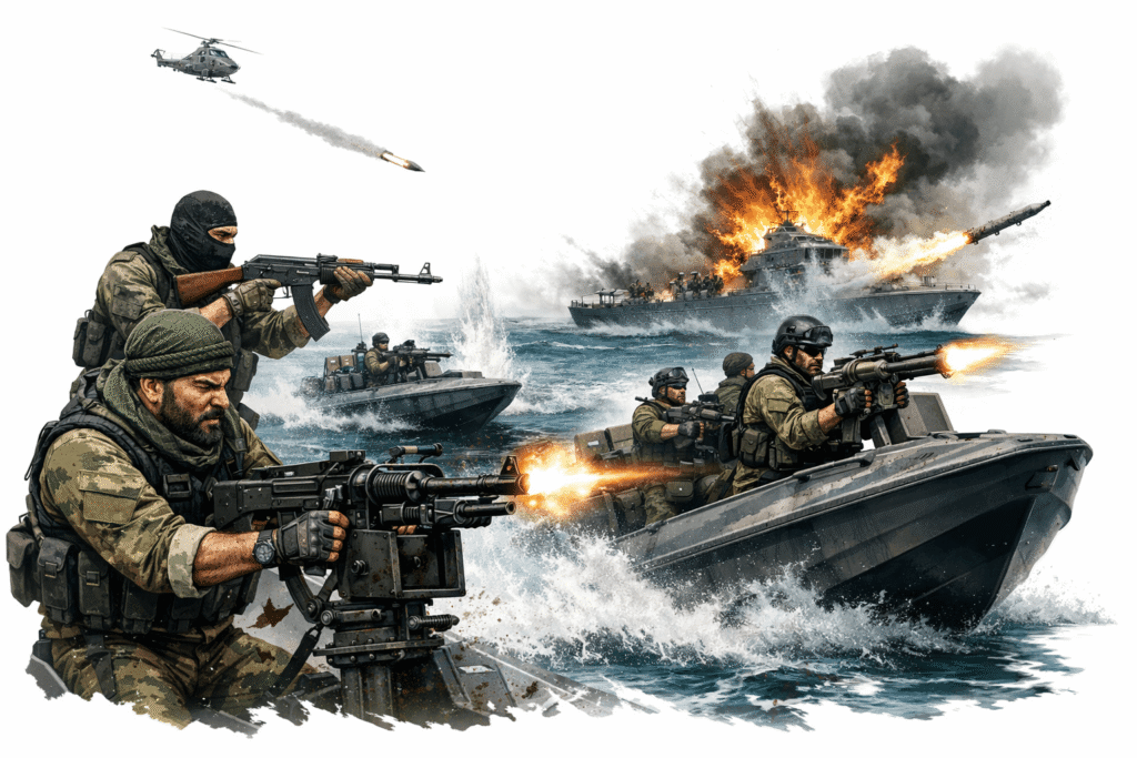
Iran’s “guerrilla navy” (IRGC fast boats) uses hit-and-run tactics, melting back into coastal waters or islands. Thirdly, limited MCM and persistence. The U.S. Navy has acknowledged shortfalls in mine countermeasures. Legacy Avengers are retired; LCS modules are few and not always forward deployed. Clearing a mined strait under fire requires continuous presence, exactly what geography makes hazardous. Historical precedents (Tanker War) show that even partial clearance demanded a massive effort. Fourthly, political, economic, and escalation risks, this forcing passage risks broader war, oil shocks ($100+/barrel spikes), and allied reluctance. Insurance markets collapse at the first incident; shipowners reroute or idle. U.S. strategy favours coalitions to share the burden, but partners hesitate in a “kill zone.” Unilateral action could fracture alliances or invite cyber/retaliatory strikes. Fifthly, attrition and industrial base. Even with air superiority, sustaining operations in the Strait erodes readiness. Shipbuilding delays hinder replacements. Iran’s hybrid approach, drones, mines, VHF warnings, selective strikes, achieves de facto closure without needing naval parity, as seen in recent 2026 disruptions where traffic plummeted despite U.S. strikes.
In essence, the U.S. excels at blue-water dominance but struggles in the littoral A2/AD environments like Hormuz. Power projection assumes open access; here, access itself is the prize, and geography awards it to the shore-based defender.
Conclusion: Lessons from a Narrow Sea
The fly-through ends as your drone exits into the Persian Gulf, but the strategic reality lingers. The Strait of Hormuz proves that geography is destiny in naval warfare. Iran’s control is neither absolute nor permanent, yet its tools, mines, missiles, swarms, exploit every topographic advantage. Countermeasures exist but demand time, treasure, and coalition will that the U.S. has historically hesitated to expend fully here. For all its carriers and precision weapons, America cannot simply “blast through” without accepting disproportionate risk. True security requires deterrence, diplomacy, and diversified energy routes beyond this 21-mile chokepoint. Until then, the strait remains a reminder that even superpowers navigate the world’s waters on terms partially dictated by rocks, depths, and shorelines.