


The Indian Space Research Organization (ISRO) and the National Aeronautics and Space Administration (NASA) are collaborating on the construction of the ‘NASA-ISRO Synthetic Aperture Radar (NISAR)’ satellite to co-develop and launch a dual-frequency synthetic aperture radar aboard an Earth observation satellite. NISAR will complete a map of the entire planet and give geographically and temporally consistent data, in a period of about 12 days. These data will help scientists comprehend how changes in the Earth’s ecosystems, ice mass, vegetation biomass, sea level rise, groundwater, and natural hazards, such as earthquakes, tsunamis, volcanoes, and landslides, have occurred over time. An official referred to it as a “real icon of U.S.-India civil space collaboration,” and they were right.
India and the United States have worked together in space since 1963 when India launched a sounding rocket made in the United States. Chandrayaan-I, India’s first moon mission, launched in 2008, and it brought with it several scientific instruments developed by international partners, including a pair of NASA instruments.
NISAR – project expectations
NISAR is the world’s most expensive Earth imaging satellite. This earth imaging satellite is likely to cost the two countries more than USD 1.5 billion, and it is also likely to be the most expensive earth imaging satellite ever built. In the context of this collaborative endeavour, NASA will be in charge of the design and development of the L-band SAR, the 12m unfillable aerial, the GPS, and the data recorder. ISRO will be in charge of the design and development of the S-band SAR, the Spacecraft Bus, the data transmission system, the integration and testing of the spacecraft, the launch using GSLV, and the operations while it is in orbit.
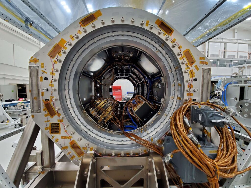
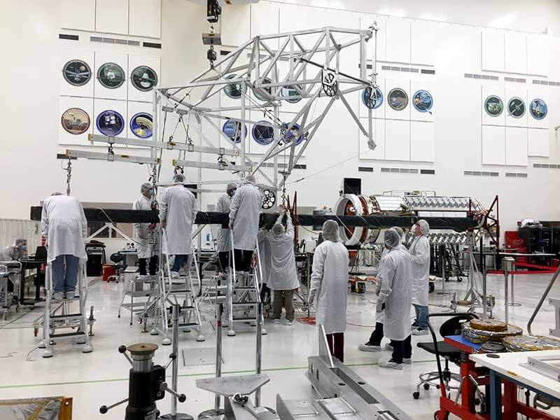
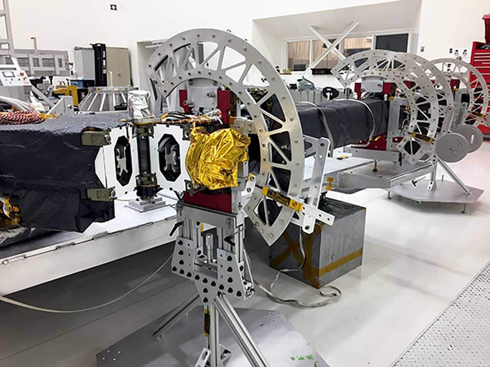
NISAR carries L and S dual-band Synthetic Aperture Radar (SAR), which operates with the Sweep SAR technique to achieve large swaths with high-resolution data. Since early 2021, engineers and technicians at Jet Propulsion Laboratory (JPL) in Southern California have been integrating and testing NISAR’s two radar systems — the L-band SAR provided by JPL and the S-band SAR built by ISRO. The satellite will be the first radar imaging satellite to use dual frequencies.
With the help of the two radars, the satellite will take weekly pictures of Earth. These pictures will provide time-lapse images of the movement of tectonic plates, ice sheets, and changes in vegetation over land used for agriculture and forests. The data obtained from Earth-imaging satellites capture images of Earth’s surface and atmosphere using various sensors and cameras. They can be used for multiple purposes, including environmental monitoring, cartography, navigation, etc. According to NASA, the goal of the mission is to conduct Earth observations and pave the way for future cooperative Mars exploration missions.
The satellite will be put into a near-polar orbit by the Satish Dhawan Space Center in Andhra Pradesh in 2024. NISAR, an earth observation satellite, was handed over to the Indian space agency by the US Air Force on 8th March.

It will be used for remote sensing to study and observe Earth’s natural processes. For example, the satellite will use advanced radar imaging to map the elevation of Earth’s land and ice masses 4 to 6 times a month. In addition, NISAR will be utilised by ISRO for several tasks, such as mapping agricultural areas and identifying landslide-prone regions.
Also Read:
NASA software to predict earthquakes in advance
NASA tests Xenon to understand the atmosphere of Mars
It will also monitor and measure some of Earth’s most complex natural processes, such as glacier collapse, ecological disruption, and natural disasters, including earthquakes, tsunamis, volcanoes, and landslides.
Information gathered by NISAR can aid in the management of natural resources and the prevention of natural disasters around the world, and it can also help scientists better understand the causes and consequences of climate change. According to NASA, the goal of the mission is to conduct Earth observations and pave the way for future cooperative Mars exploration missions.
NISAR -strategic significance
Satellites equipped with sensors and cameras are called Earth-imaging satellites, and they take pictures of Earth’s surface and atmosphere. These satellites’ utility is vast, from navigation and mapping to environmental monitoring. The military forces of various countries use the Earth observation satellite for spying and communicating. The most well-known application of EOS is in Google Earth’s pictures, and the new angle on the world they offer. Satellites with Earth-viewing cameras are increasingly used for spying by militaries worldwide.
However, the project will give impetus to ISRO’s capacity building for its space projects for exploration missions. NISAR was not designed for intelligence gathering and surveillance purposes. It will be possible to conduct strategic studies of the topography of locations that are either inaccessible or difficult to reach. One can draw several important conclusions by conducting an in-depth analysis of the compiled data. The results of such an investigation could point to the next course of action.